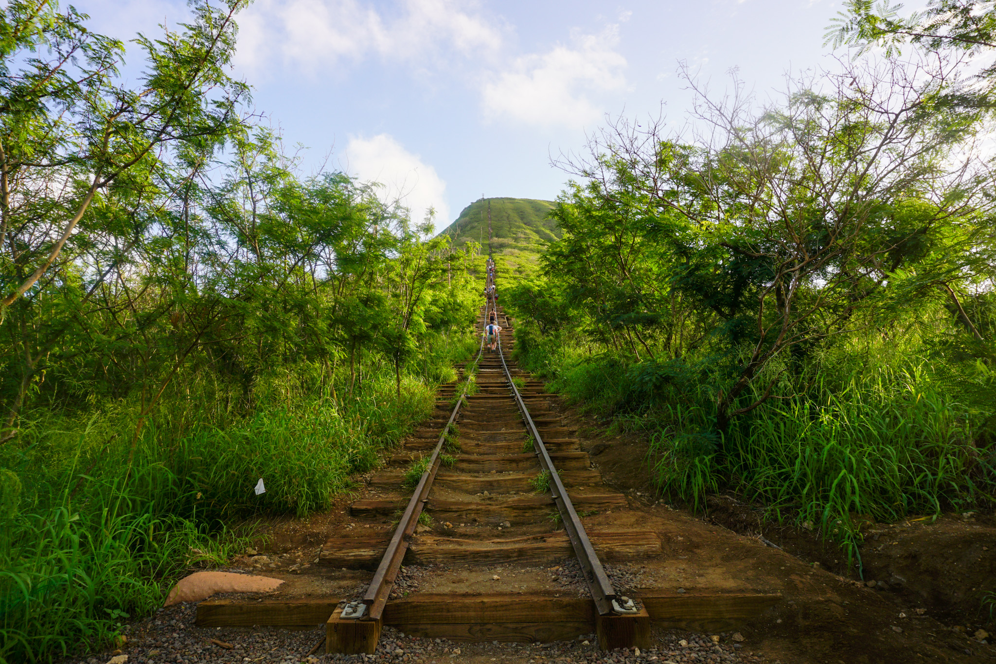
If you enjoy a challenging incline and love a good leg burn, then the Koko Head (aka Koko Crater Trail) is the hike for you! This popular hike features roughly 800 of the original 1,048 “stairs” which are really just planks that make up an old railway leading to the Pu’u Mai Summit, where the island’s best views of the Maunalua Region await.
Hiking Safety Disclaimer: Hiking in Hawaii can be extremely dangerous. Please keep your personal fitness and skill levels in mind as certain hikes may require a certain level of ability. Always take proper safety precautions and remember to check weather forecasts, currents and tides!
Koko Crater is a stunning volcanic cinder cone located on the southeast side of Oahu. If you aren’t up for the hike to the top, you’ll still be treated to its stunning beauty just by driving in the surrounding area.
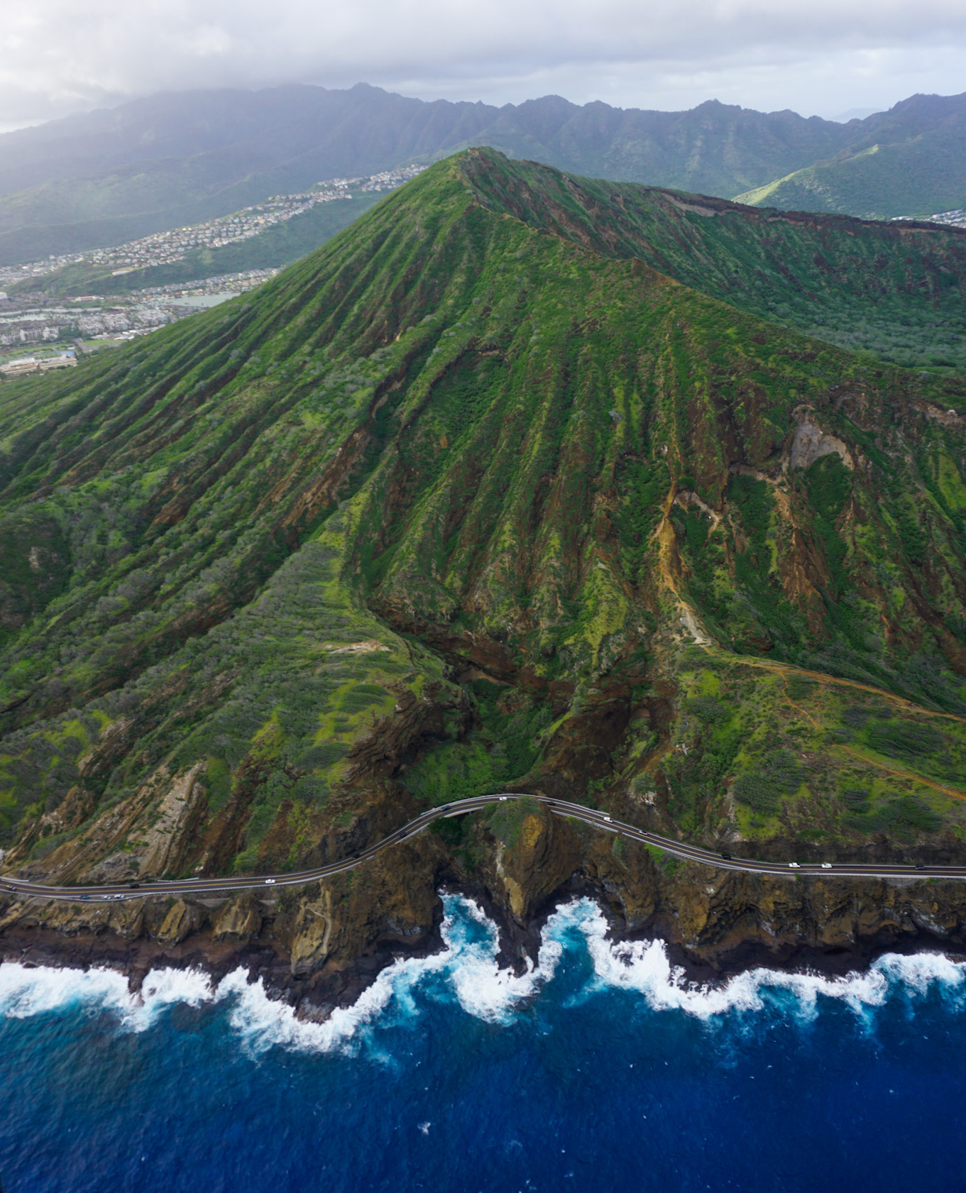
You might be asking, “Wait, why is there a railway mounted to the side of a volcanic crater?” During World War II, the military built lookout points called pillboxes at the top of high points around the island including Koko Crater. A tramway was installed to transport people, supplies, and cargo via a tramcar up to the summit. What remains of the tramway now serves as the trail to the top of this world-famous hike.
As you can imagine, the stairs take a beating from 500-1,000 daily hikers, erosion, storms and intense rainfall, and general lack of maintenance. Luckily, a group called the Kokonut Koalition was started with a mission to preserve and maintain the stairs so locals and tourists alike could continue to enjoy the challenging but rewarding experience. Read more about Kokonut Koalition’s mission here and consider making a donation to help their efforts.
The Details
Highlights: The unbelievable incline means equally unbelievable views. The grind is worth it to see the island from a panoramic POV, especially if you choose to go for sunrise!
Difficulty: Moderate-Hard – This is a challenging hike with a steep incline.
Hike Type: Out and Back (You’ll return the same way you came)
Length: 1.8 miles total from the Koko Head District Park parking lot. There are about 0.7 miles of steep steps to the summit. You’ll reach a height of almost 1,000 feet by the time you hit the top.
It is free to park and hike but consider donating towards Kokonut Koalition’s efforts to maintain the stairs.
There is a bathroom located in Koko Head District Park (where you will park). As you enter into the parking lot, you will see a bathroom on your left side.
Bring your own drinking water with you (You will need it!)
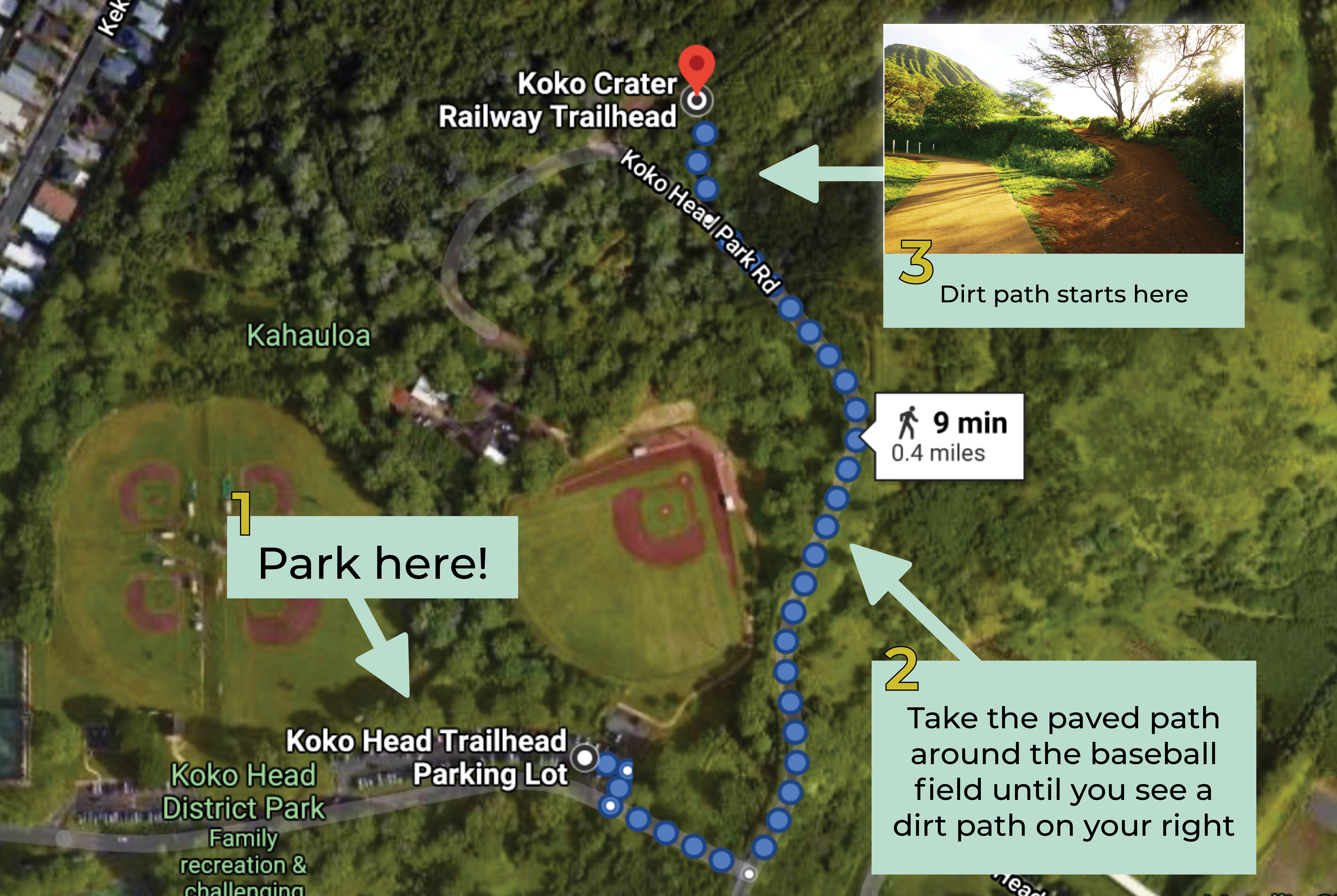
Location: The easiest place to park is the Koko Head District Park parking lot: 423 Kaumakani St, Honolulu, HI 96825
You’ll have to walk on the paved path around the baseball field until you see a dirt path to the right that will lead you to the base of Koko Crater where the steps begin.
Some interesting things you may not know:
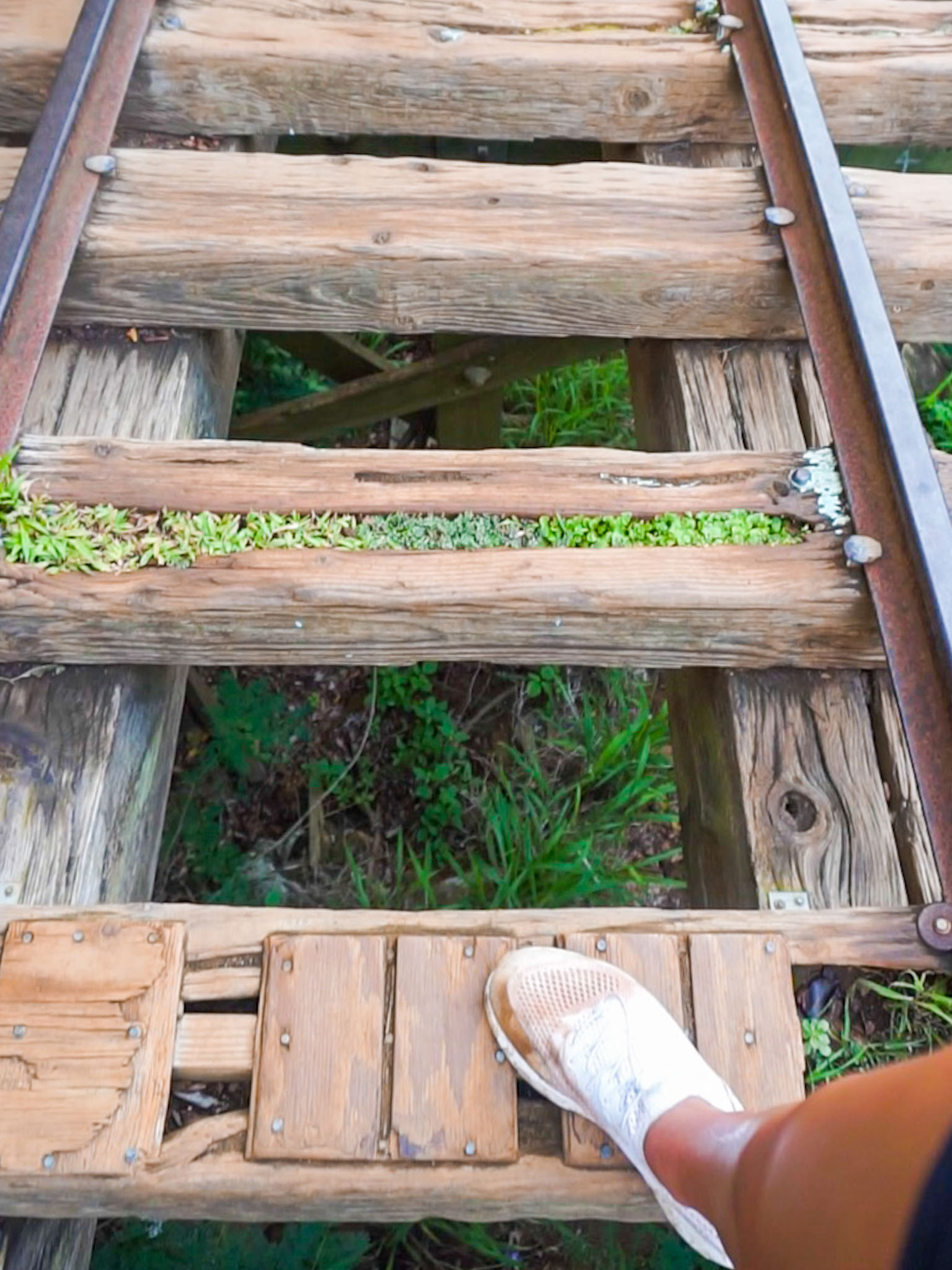
A short portion of the tramway is mounted to a part of the crater hovering over a 20ft drop into a ravine. This “bridge” part of the trail is not for the faint of heart or those who have a fear of heights! Luckily, there is a safe way to bypass this part using a dirt trail along the side.
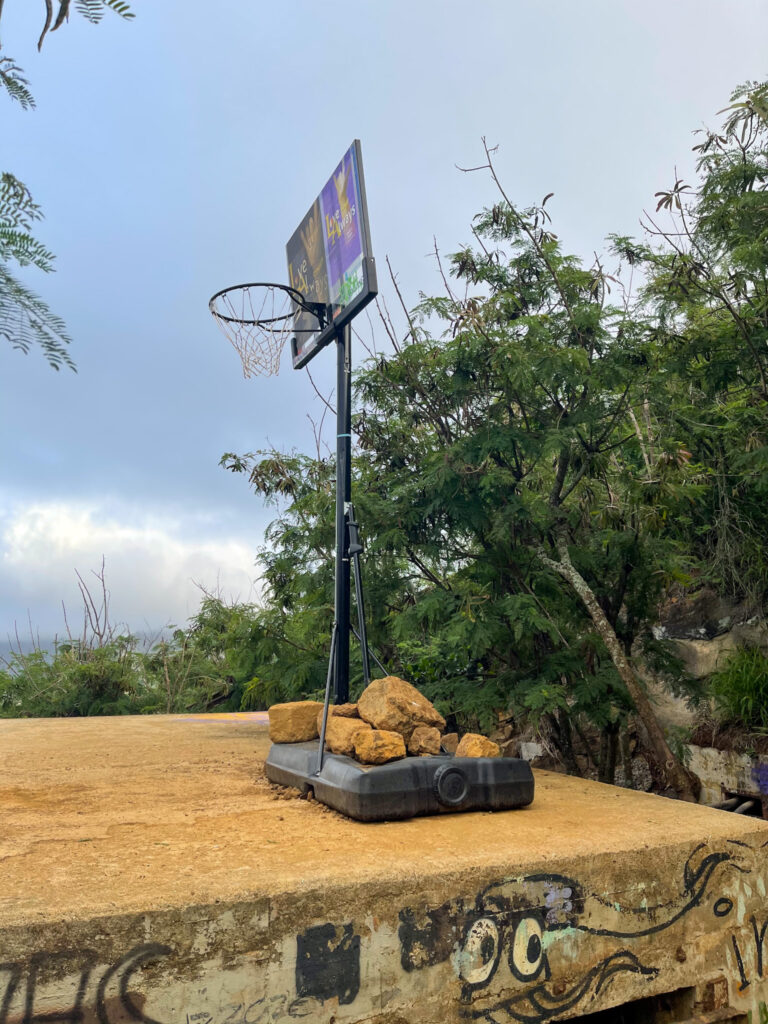
There is a basketball hoop at the top of the summit! This is probably THE coolest place to shoot a few free throws. I guess you could carry a ball up with you using a backpack (or maybe inflate one at the top) 🤷♀️
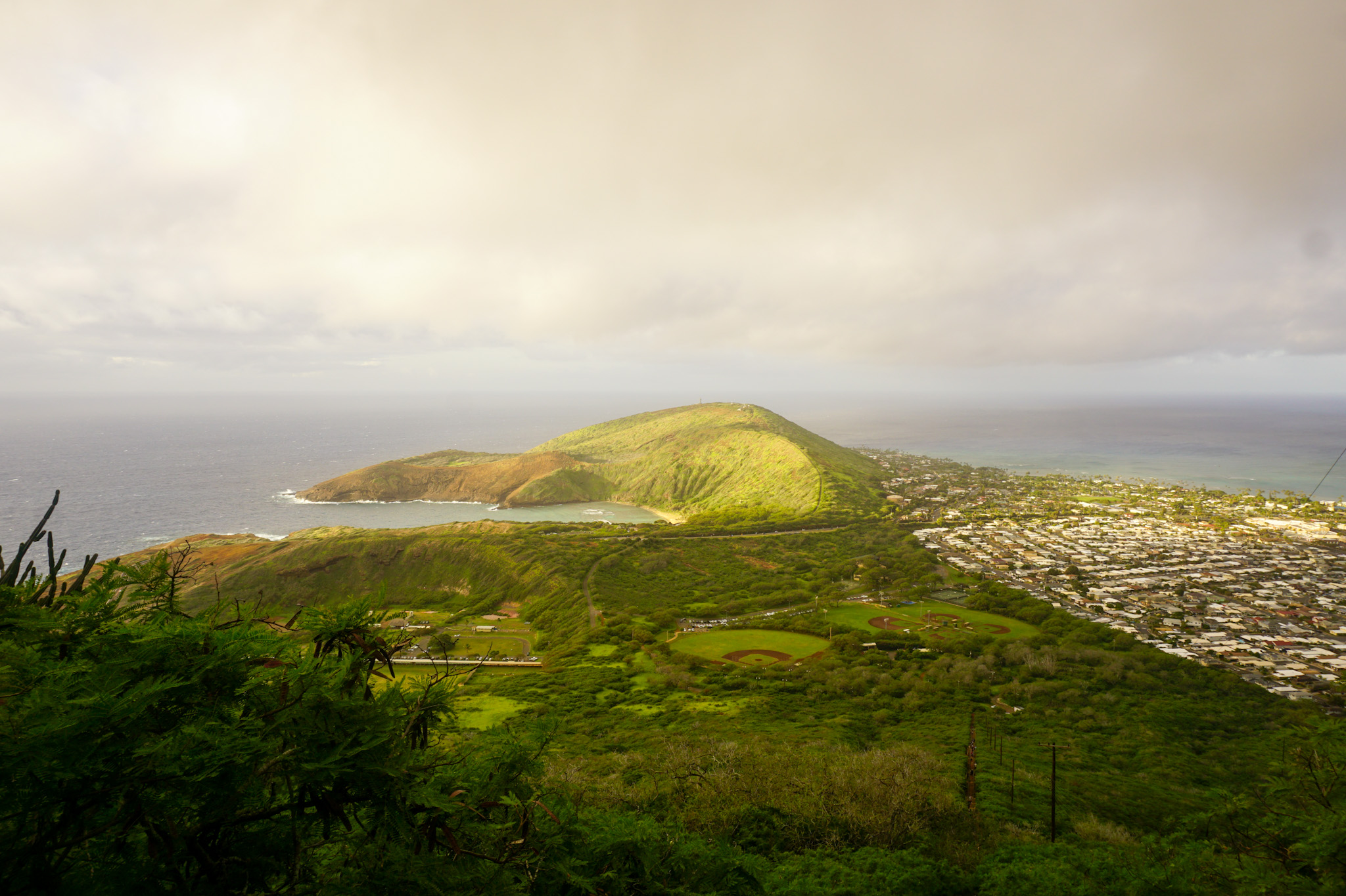
Some locals do this hike multiple times in one day. One guy passed me TWICE on my way up, zoomed past me while I was climbing down, and began the trail again just as I reached the end. Impressive. Standing at the base, looking up at the hundreds of stairs towering above me, I momentarily imagined what it would be like to start the hike all over again…no thank you!
What time of day should you go?
Sunrise is a good choice to avoid the heat (there is not shade on the trail) and large crowds. If you choose to go for sunrise, make sure to plan your hike by working backward from the time the sun rises. For example, if the sunrise will happen at 6:30 am, you’ll probably want to get to the top at 6:15 am to find a spot to hydrate, catch your breath, and get your camera ready if you’re planning to take some pics.
Arrive at Koko Head District Park Parking Lot: 5:20 am
Walk to trailhead and start hike: 5:30 am
(It can generally take 30 minutes to an hour to get to the summit. You’re better off having extra time to make sure you catch the sunrise than to put in all that work and miss it because the trail was more challenging than you expected)
Arrive at the summit in time for sunrise: 6:15 am
If you go during the day once the sun is already up, you’ll be able to enjoy the vibrant views of the island and the ocean in broad daylight. This also means the sun may be beating down on you as you trek up seemingly endless stairs.
Regardless of when you go, bring lots of water and wear sunscreen! I also recommend leaving anything behind that may unnecessarily weigh you down. I had about 15 pounds of camera accessories and gear in my backpack and I was STRUGGLING.
Beginning of the hike
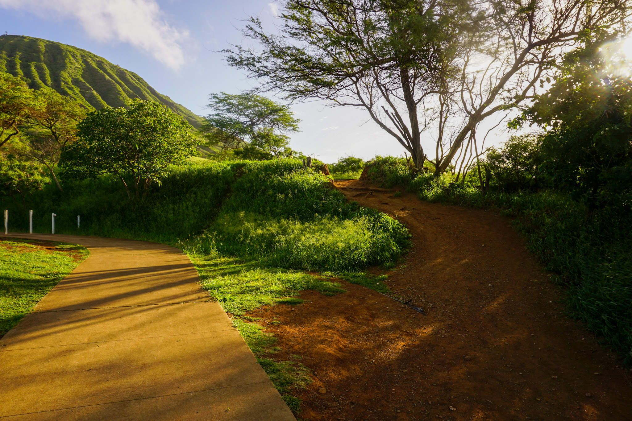
We parked in the Koko Head District Park lot and started looking for the trail entrance in the dark. It can be kind of hard to find if you are unfamiliar, especially without any sunlight!
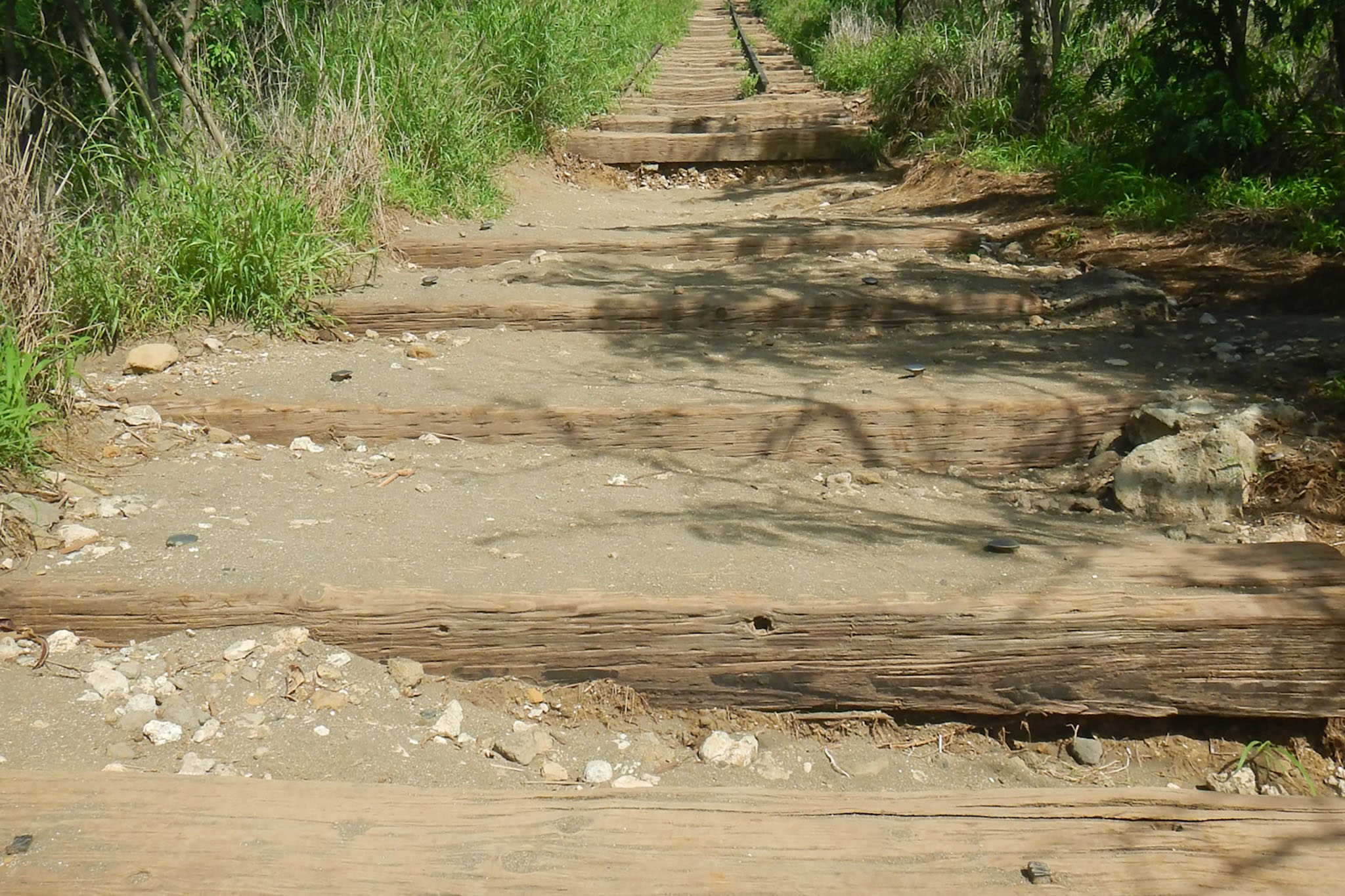
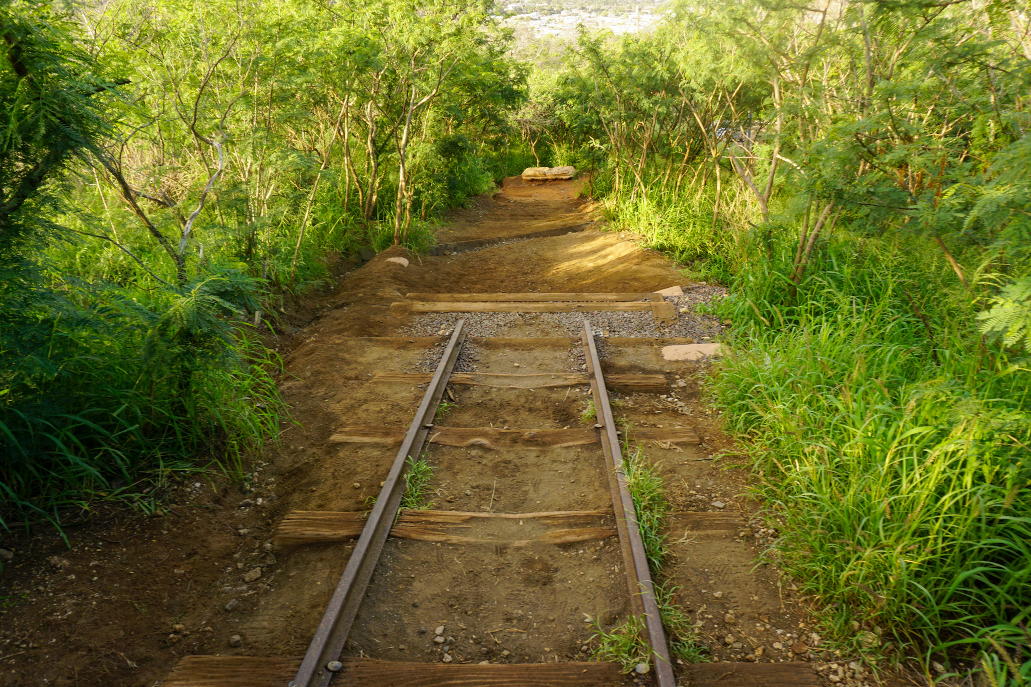
The stairs start out moderately easy. The gaps between the first dozen or so planks are packed with dirt and gravel, making them feel like actual stairs. As you continue to climb, the planks have bigger gaps with a decent amount of space between the wood and the ground underneath. I switched between stepping from plank to plank and stepping over the planks placing my foot on the dirt.
Almost there!

You’ll come to a point where the steps act as a bridge hovering above a ravine with a 20-30 foot drop beneath. I braved the “bridge” both ways, but you can follow signs that point to a bypass right next to the steps. I didn’t think much of it on my way up in the dark, but I was way more freaked out on my way down when I could actually see the steep drop through the gaps in the planks!
The sky was getting a hint brighter now and I could hear the sound of what seemed like a thousand roosters and chickens below alerting the neighborhood that a new day had begun. I stepped off to the side of the narrow trail to let a group pass by as they made their way down, grateful for the chance to grab some water, catch my breath, and prepare for the remaining climb. Even though it was still pretty dark, I could clearly see the second half of the climb only got steeper and sketchier from here. I groaned looking at my Apple Watch realizing I would have to really hustle up the vertical stretch ahead in order to make it to the top for sunrise.
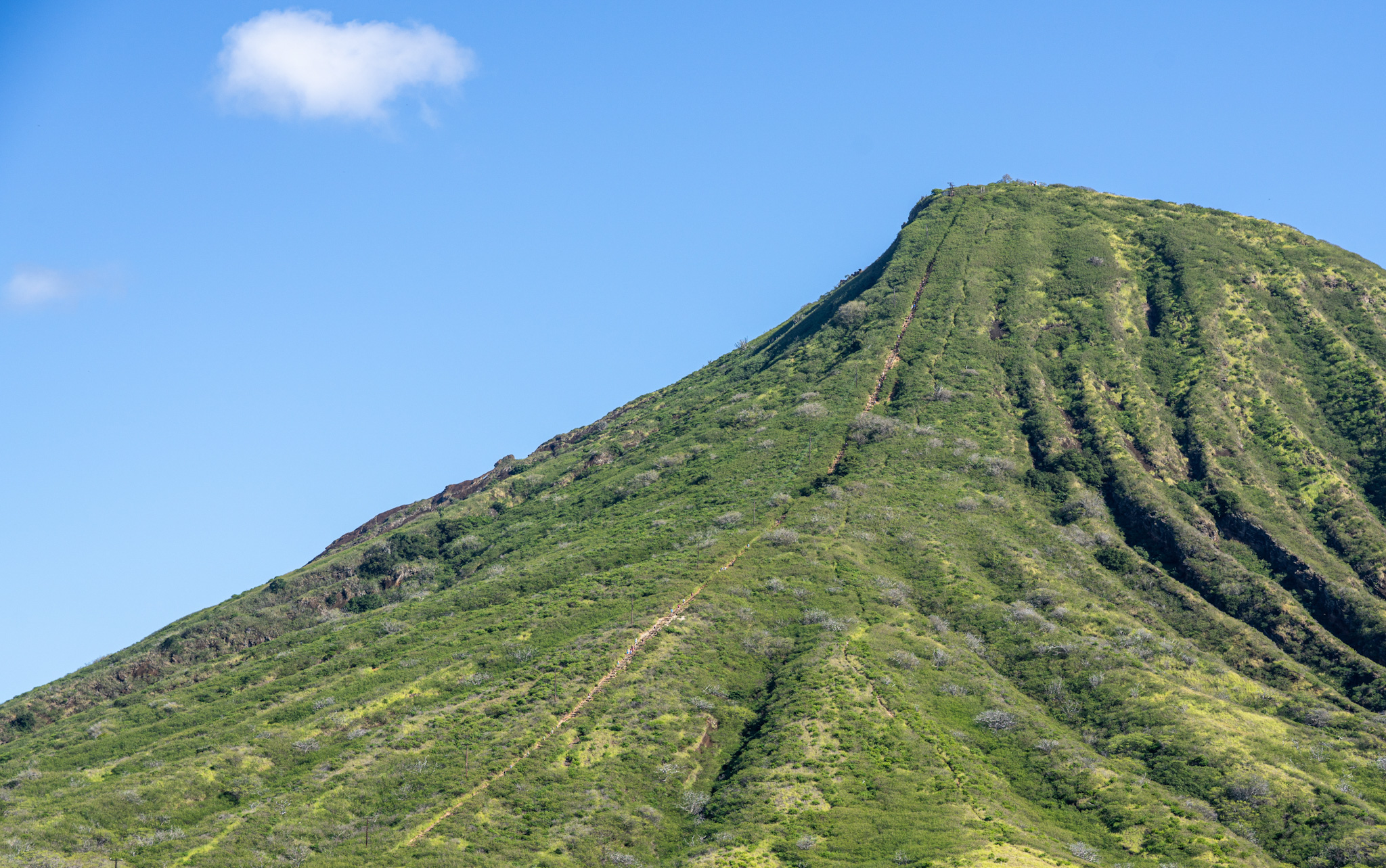
Conquering those last 20-30 stairs is tough, but once you hit that final step you’ll feel invincible…until you see there’s ANOTHER small rocky hill to climb to get to the actual summit. Don’t worry, it’s short and easy! Once you’re finally on a flat surface at the summit, you’ll feel like you’re on top of the world (literally).
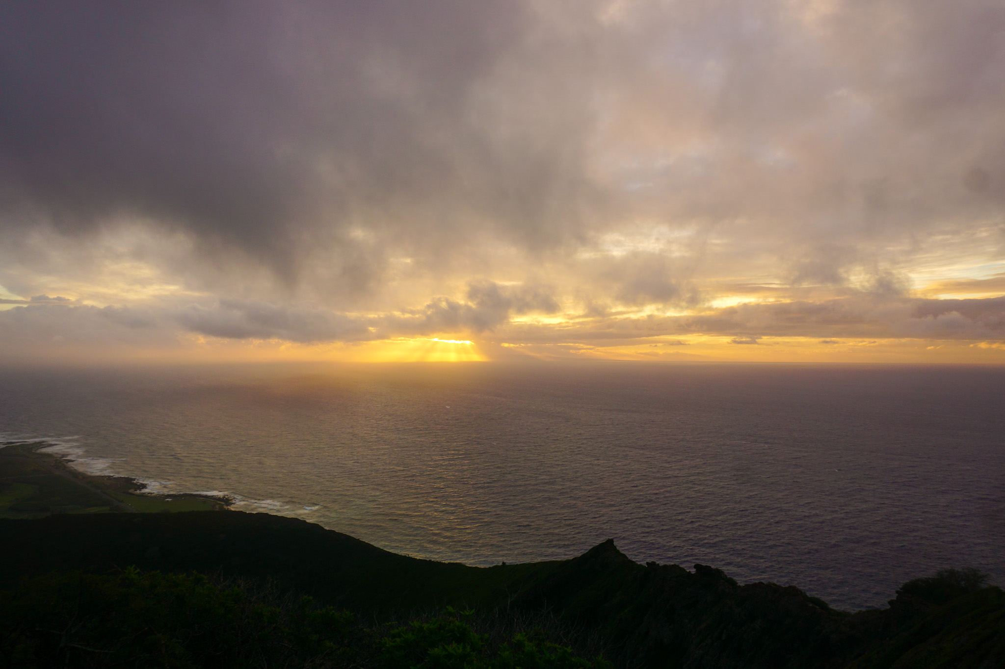
Enjoy the view and take the time you need to catch your breath and rest your legs before hiking back down. You’re not quite in the clear yet.
The hike down:
Getting down the stairs presents a challenge of its own. The steps are covered in dirt and small rocks which can make the hike down slippery. Take your time and let hikers moving quicker than you pass by. I found it easier to go down using the wooden steps versus the dirt path alongside the steps because I was sliding all over the place and there is nothing to grab onto besides a few flimsy branches.




2 Responses